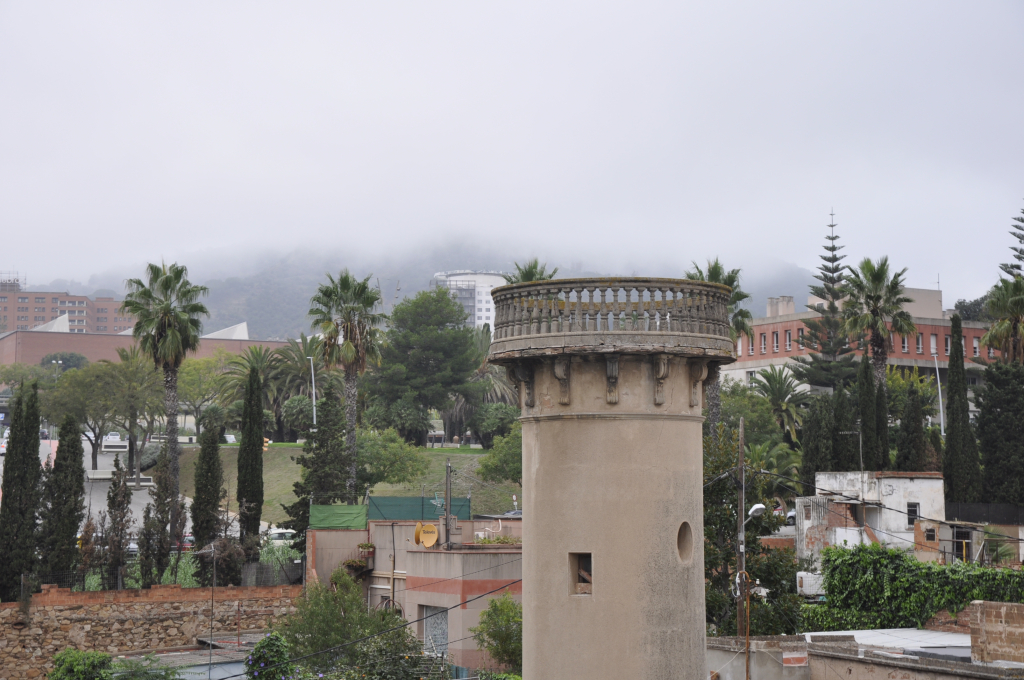
The latest available average property sale price in La Clota neighbourhood is 4,668 €/m² for the full year 2025, according to Barcelona City Council. This is an average of recorded transactions for that period, not a current valuation of an individual home.
Archive photograph · Anastasiia Khvatova · CC BY-SA 4.0
Official data from Barcelona City Council. Each figure includes its reference date so you can distinguish the latest available data from the current year.
01 · The housing market
Neighbourhood prices and property sales
Prices paid in recorded transactions, how prices have changed and the ownership of the existing housing stock.
The property sales market
Four key figures for recorded property sales: price per square metre, number of transactions, average purchase price and floor area of homes sold.
Average sale price per m²
4,668 €/m²
2025 · full year
+25.9%compared with the previous year
Residential property sales
7
2025 · full year
-63.2%compared with the previous year
Average price per home
542,036 €
2025 · full year
+41.1%compared with the previous year
Average area of homes sold
118.4 m²
2025 · full year
+13.2%compared with the previous year
Average sale price per m² over time
Recorded property sales · euros per square metre
— No published or validated figure for that year. The line breaks; missing values are not estimated.
Scroll the chart to see every year.
Compare with Horta-Guinardó and Barcelona
Each row states its full reference year. The same period is used for all three areas.
Indicator / category
La Clota
Horta-Guinardó
Barcelona
Average sale price per m² 2025 · full year
4,668 €/m²
3,451 €/m²
4,254 €/m²
Residential property sales 2025 · full year
7
1,653
16,897
Average price per home 2025 · full year
542,036 €
254,868 €
372,930 €
Average area of homes sold 2025 · full year
118.4 m²
74.2 m²
86.4 m²
Averages from recorded transactions; these are not individual valuations. The floor area refers to the homes sold.
Source: Barcelona City Council · OMD · Notarial records
2025 · full year
Price by construction period
The average price per square metre of homes sold, grouped by construction period. Figures relate to the stated year, rather than an average across the historical series. Open the historical table to follow each group over time.
2020–present4,668 €/m²
Compare with Horta-Guinardó and Barcelona
2025 · full year · The same period is used for all three areas.
Indicator / category
La Clota
Horta-Guinardó
Barcelona
2020–present
4,668 €/m²
4,915 €/m²
5,731 €/m²
2000–2020
Not published
3,373 €/m²
4,904 €/m²
1980–1999
Not published
3,583 €/m²
4,373 €/m²
1960–1979
Not published
3,420 €/m²
3,944 €/m²
1940–1959
Not published
3,398 €/m²
4,105 €/m²
1920–1939
Not published
3,694 €/m²
4,772 €/m²
1900–1919
Not published
3,576 €/m²
4,640 €/m²
Before 1900
Not published
Not published
4,308 €/m²
Not recorded
Not published
3,314 €/m²
4,278 €/m²
Average sales with at least five observations, restricted to horizontal property. Differences do not isolate the effect of age and are not individual valuations.
View historical data
2014 · full year – 2025 · full year · Most recent first
Category
2025 · full year
2024 · full year
2016 · full year
2015 · full year
2014 · full year
2020–present
4,668 €/m²
4,047 €/m²
Not published
Not published
Not published
Not recorded
Not published
Not published
758 €/m²
1,709 €/m²
873 €/m²
Source: Barcelona City Council · OMD
09/03/2026
Registered ownership
The distribution of homes by their first registered cadastral holder: individuals, companies, public bodies and other entities.
“Individual — Spanish nationality” is the largest category, accounting for 81.6% of the total.
82.7 %
of homes have an individual as their first registered cadastral holder.
Compare with Horta-Guinardó and Barcelona
09/03/2026 · The same period is used for all three areas. Percentage of each area’s total where the source permits calculation; below, the number of homes.
Indicator / category
La Clota
Horta-Guinardó
Barcelona
Individual — Spanish nationality
81.6 %510 homes
87.3 %75,920 homes
78.8 %659,066 homes
Individual — foreign nationality
1.1 %7 homes
3.3 %2,902 homes
5.6 %47,005 homes
Public limited company
Not published
1.4 %1,254 homes
2.1 %17,525 homes
Limited liability / civil company
10.7 %67 homes
5.6 %4,837 homes
10.0 %83,338 homes
Other companies and associations
0.2 %1 homes
0.8 %670 homes
1.0 %8,237 homes
Foreign entities
Not published
0.0 %4 homes
0.1 %691 homes
Public bodies
5.6 %35 homes
1.1 %992 homes
2.0 %16,387 homes
Religious institutions
0.6 %4 homes
0.1 %94 homes
0.2 %1,534 homes
Other types / joint ventures
Not published
0.0 %2 homes
0.0 %123 homes
Not recorded
0.2 %1 homes
0.3 %290 homes
0.3 %2,715 homes
Based on the first cadastral holder; this does not identify large landlords or how each home is used.
View historical data
01/01/2022 – 09/03/2026 · Most recent first
Category
09/03/2026
04/03/2025
26/02/2024
06/03/2023
01/01/2022
Individual — Spanish nationality
510
492
394
327
323
Individual — foreign nationality
7
6
Not published
Not published
Not published
Limited liability / civil company
67
85
61
61
61
Other companies and associations
1
1
21
1
1
Public bodies
35
35
41
23
22
Religious institutions
4
4
4
4
4
Not recorded
1
2
1
1
5
Source: Barcelona City Council · OMD · Cadastre / property tax
02 · The housing stock
Homes in the neighbourhood
Floor areas, construction periods and the number of homes. A picture of the housing stock that puts your own property in context.
09/03/2026
How does your home compare in size?
Compare your home’s floor area with the sizes found in the neighbourhood and see what share each range represents.
“61–90 m²” is the largest category, accounting for 39.8% of the total.
<30 m²5.6 %35 homes
31–60 m²25.9 %162 homes
61–90 m²39.8 %249 homes
91–120 m²27.2 %170 homes
121–150 m²1.3 %8 homes
151–210 m²0.2 %1 homes
Compare with Horta-Guinardó and Barcelona
09/03/2026 · The same period is used for all three areas. Percentage of each area’s total where the source permits calculation; below, the number of homes.
Indicator / category
La Clota
Horta-Guinardó
Barcelona
<30 m²
5.6 %35 homes
3.9 %3,413 homes
3.0 %25,014 homes
31–60 m²
25.9 %162 homes
34.1 %29,658 homes
27.2 %227,392 homes
61–90 m²
39.8 %249 homes
49.9 %43,408 homes
46.0 %384,437 homes
91–120 m²
27.2 %170 homes
9.9 %8,588 homes
15.6 %130,240 homes
121–150 m²
1.3 %8 homes
1.7 %1,479 homes
4.4 %36,538 homes
151–210 m²
0.2 %1 homes
0.4 %327 homes
2.9 %24,203 homes
211–250 m²
Not published
0.0 %40 homes
0.6 %4,719 homes
>250 m²
Not published
0.1 %52 homes
0.5 %4,078 homes
Existing cadastral housing stock; these are not current listings.
View historical data
01/01/2022 – 09/03/2026 · Most recent first
Category
09/03/2026
04/03/2025
26/02/2024
06/03/2023
01/01/2022
<30 m²
35
35
36
36
36
31–60 m²
162
162
146
146
145
61–90 m²
249
249
187
180
180
91–120 m²
170
170
149
51
51
121–150 m²
8
8
3
3
3
151–210 m²
1
1
1
1
1
Source: Barcelona City Council · OMD · Cadastre / property tax
09/03/2026
When the homes were built
See how homes are distributed by construction year and which periods account for the largest share of the housing stock.
“2021–2030” is the largest category, accounting for 33.8% of the total.
Percentage above each bar · Number of homes below each period
13.6 %
<190185
10.1 %
1901–194063
5.8 %
1941–195036
7.4 %
1951–196046
7.5 %
1961–197047
0.2 %
1981–19901
21.8 %
2011–2020136
33.8 %
2021–2030211
Scroll the chart to see every period.Compare with Horta-Guinardó and Barcelona
09/03/2026 · The same period is used for all three areas. Percentage of each area’s total where the source permits calculation; below, the number of homes.
Indicator / category
La Clota
Horta-Guinardó
Barcelona
<1901
13.6 %85 homes
1.1 %922 homes
9.5 %79,125 homes
1901–1940
10.1 %63 homes
5.8 %5,029 homes
14.2 %118,546 homes
1941–1950
5.8 %36 homes
3.4 %2,926 homes
3.0 %24,697 homes
1951–1960
7.4 %46 homes
14.1 %12,296 homes
9.4 %78,578 homes
1961–1970
7.5 %47 homes
37.8 %32,846 homes
24.9 %208,397 homes
1971–1980
Not published
21.5 %18,737 homes
20.6 %171,941 homes
1981–1990
0.2 %1 homes
4.3 %3,728 homes
4.7 %39,394 homes
1991–2000
Not published
4.8 %4,202 homes
5.0 %41,970 homes
2001–2010
Not published
4.3 %3,762 homes
5.6 %46,677 homes
2011–2020
21.8 %136 homes
1.7 %1,517 homes
2.0 %16,530 homes
2021–2030
33.8 %211 homes
1.1 %1,000 homes
1.3 %10,766 homes
Building age does not indicate condition or renovation history.
View historical data
01/01/2022 – 09/03/2026 · Most recent first
Category
09/03/2026
04/03/2025
26/02/2024
06/03/2023
01/01/2022
<1901
85
85
85
85
85
1901–1940
63
63
63
63
63
1941–1950
36
36
36
36
37
1951–1960
46
46
47
47
47
1961–1970
47
47
47
47
47
1981–1990
1
1
1
1
1
2011–2020
136
136
136
136
136
2021–2030
211
211
107
2
Not published
Source: Barcelona City Council · OMD · Cadastre / property tax
09/03/2026
Average size of existing homes
The average floor area of homes in the cadastre, compared with the district and Barcelona as a whole.
The change from the previous annual edition is below 0.1%.
72.6 m²
Compare with Horta-Guinardó and Barcelona
09/03/2026 · The same period is used for all three areas.
La Clota72.6 m²
Horta-Guinardó67.4 m²
Barcelona77.9 m²
Existing cadastral housing stock; these are not current listings.
View historical data
01/01/2022 – 09/03/2026 · Most recent first
Date
Value
09/03/2026
72.6 m²
04/03/2025
72.6 m²
26/02/2024
71.2 m²
06/03/2023
64.3 m²
01/01/2022
64.4 m²
Source: Barcelona City Council · OMD · Cadastre / property tax
09/03/2026
Average age of homes
The average age of the housing stock, calculated from construction years. Compare the neighbourhood with its district and the city.
Change from the previous annual edition: +2.2%.
45.6 years
Compare with Horta-Guinardó and Barcelona
09/03/2026 · The same period is used for all three areas.
La Clota45.6 years
Horta-Guinardó57.3 years
Barcelona66.5 years
Building age does not indicate condition or renovation history.
View historical data
01/01/2022 – 09/03/2026 · Most recent first
Date
Value
09/03/2026
45.6 years
04/03/2025
44.6 years
26/02/2024
52.2 years
06/03/2023
64.1 years
01/01/2022
63.4 years
Source: Barcelona City Council · OMD · Cadastre / property tax
09/03/2026
Homes in the neighbourhood
The number of homes recorded in the cadastre. Explore the trend and compare it with totals for the district and Barcelona.
The change from the previous annual edition is below 0.1%.
625
Compare with Horta-Guinardó and Barcelona
09/03/2026 · The same period is used for all three areas.
Indicator / category
La Clota
Horta-Guinardó
Barcelona
Homes in the neighbourhood
625
86,965
836,621
Existing cadastral housing stock; these are not current listings.
View historical data
01/01/2022 – 09/03/2026 · Most recent first
Date
Value
09/03/2026
625
04/03/2025
625
26/02/2024
522
06/03/2023
417
01/01/2022
416
Source: Barcelona City Council · OMD · Cadastre / property tax
03 · Life in the neighbourhood
Households, residents and disposable income
Household composition and residents’ economic context, with comparisons between areas where the data allow.
01/01/2026
People registered at each address
The distribution of neighbourhood households by the number of people registered at each address.
“One person” is the largest category, accounting for 31.6% of the total.
One person31.6 %148 households
Two people28.4 %133 households
Three people20.7 %97 households
Four people13.5 %63 households
Five people3.0 %14 households
Six people1.5 %7 households
Seven people0.9 %4 households
Nine or more people0.4 %2 households
Compare with Horta-Guinardó and Barcelona
01/01/2026 · The same period is used for all three areas. Percentage of each area’s total where the source permits calculation; below, the number of households.
Indicator / category
La Clota
Horta-Guinardó
Barcelona
One person
31.6 %148 households
30.5 %22,215 households
31.9 %218,433 households
Two people
28.4 %133 households
30.4 %22,186 households
29.5 %201,690 households
Three people
20.7 %97 households
18.6 %13,569 households
17.6 %120,498 households
Four people
13.5 %63 households
13.1 %9,517 households
12.7 %86,631 households
Five people
3.0 %14 households
4.0 %2,941 households
4.4 %30,379 households
Six people
1.5 %7 households
1.6 %1,136 households
1.8 %12,508 households
Seven people
0.9 %4 households
0.8 %560 households
0.9 %6,005 households
Eight people
Not published
0.4 %312 households
0.5 %3,256 households
Nine or more people
0.4 %2 households
0.6 %426 households
0.7 %4,677 households
Municipal register addresses. These figures describe residents, not buyers.
View historical data
01/01/2022 – 01/01/2026 · Most recent first
Category
01/01/2026
01/01/2025
01/01/2024
01/01/2023
01/01/2022
One person
148
137
110
86
97
Two people
133
139
93
65
64
Three people
97
89
76
68
67
Four people
63
57
54
44
40
Five people
14
16
9
10
7
Six people
7
4
2
3
2
Seven people
4
2
3
2
1
Eight people
Not published
Not published
1
Not published
2
Nine or more people
2
4
1
2
1
Source: Barcelona City Council · OMD · Municipal population register
01/01/2026
Children registered at each address
The distribution of households by the number of registered residents under 18. The chart separates households with children from those without.
“No one under 18” is the largest category, accounting for 69.2% of the total.
30.8% of addresses have at least one registered resident under 18.
30.8 %with children
With residents under 18
Without residents under 18
Compare with Horta-Guinardó and Barcelona
01/01/2026 · The same period is used for all three areas. Percentage of each area’s total where the source permits calculation; below, the number of households.
Indicator / category
La Clota
Horta-Guinardó
Barcelona
No one under 18
69.2 %324 households
78.1 %56,891 households
78.6 %538,014 households
One person under 18
17.3 %81 households
13.0 %9,445 households
12.1 %82,743 households
Two people under 18
11.1 %52 households
7.4 %5,363 households
7.4 %50,744 households
Three people under 18
1.5 %7 households
1.2 %897 households
1.4 %9,886 households
Four or more people under 18
0.9 %4 households
0.4 %266 households
0.4 %2,690 households
Municipal register addresses. These figures describe residents, not buyers.
View historical data
01/01/2022 – 01/01/2026 · Most recent first
Category
01/01/2026
01/01/2025
01/01/2024
01/01/2023
01/01/2022
No one under 18
324
310
240
191
199
One person under 18
81
80
57
48
45
Two people under 18
52
49
45
35
33
Three people under 18
7
6
6
5
3
Four or more people under 18
4
3
1
1
1
Source: Barcelona City Council · OMD · Municipal population register
01/01/2026
Registered households
The number of addresses with registered residents. One address may be home to one or more people; this differs from the total number of homes in the cadastre.
Change from the previous annual edition: +4.5%.
468
Compare with Horta-Guinardó and Barcelona
01/01/2026 · The same period is used for all three areas.
Indicator / category
La Clota
Horta-Guinardó
Barcelona
Registered households
468
72,862
684,077
Municipal register addresses. These figures describe residents, not buyers.
View historical data
01/01/2022 – 01/01/2026 · Most recent first
Date
Value
01/01/2026
468
01/01/2025
448
01/01/2024
349
01/01/2023
280
01/01/2022
281
Source: Barcelona City Council · OMD · Municipal population register
2023
Disposable income per resident
Annual disposable income per neighbourhood resident, compared with the district and Barcelona for the same year.
Change from the previous annual edition: +11.4%.
24,289 €
Compare with Horta-Guinardó and Barcelona
2023 · The same period is used for all three areas.
La Clota24,289 €
Horta-Guinardó23,066 €
Barcelona26,069 €
Annual disposable income per resident. This is not a salary or buyers’ budget.
View historical data
2019 – 2023 · Most recent first
Date
Value
2023
24,289 €
2022
21,805 €
2021
21,312 €
2020
19,510 €
2019
20,287 €
Source: Barcelona City Council · OMD
04 · History and housing
La Clota: Barcelona’s rural traces
La Clota · Horta-Guinardó · Barcelona
Neighbourhood history
La Clota retains traces of market gardens, farmhouses and laundry workers in a hollow between Horta, El Carmel and La Vall d’Hebron. Abundant water supported cultivation, while limited urban growth preserved houses and street patterns rooted in its rural past.
In a small neighbourhood, a handful of transactions can shift the annual average substantially. Compare homes of similar type and size, review building condition and property documentation, and avoid applying a new apartment block’s price to an older house without appropriate adjustments.
A useful comparison starts with understanding what each figure measures. Open the historical tables and read the notes accompanying each indicator.
Are these asking prices or recorded sale prices?
The market section uses averages from recorded transactions, based on notarial statistics published by the City Council. These differ from the asking prices shown on property portals.
Why do the reference dates differ?
Sales, cadastral, population register and income data are released on different schedules. Each section shows its reference period. Viewing this page today does not mean all indicators relate to the same year.
Does the average floor area cover all homes?
The sales section measures the homes that were sold. The housing stock section measures homes recorded in the cadastre. These are different populations, so their averages can differ.
What do “Suppressed” and “Not published” mean?
“Suppressed” means the source withholds the information to protect confidentiality. “Not published” means no value is available for the category and period shown. Neither expression means zero.
Can I value my home using the price per m²?
The neighbourhood average is a general reference. An individual valuation requires an assessment of the exact location, floor area, floor level, lift, natural light, condition and building characteristics, together with suitable comparable properties.
You can drop in without an appointment to discuss your property, ask questions and arrange an in-person valuation. We help you sell homes throughout Barcelona.
Espai Sant Joan
PUNTO HABITAT Passeig de Sant Joan, 150 · Barcelona 93 539 14 10
Please enter your username or email address. You will receive a link to create a new password via email.
Gestionar el consentimiento de las cookies
Para ofrecer las mejores experiencias, utilizamos tecnologías como las cookies para almacenar y/o acceder a la información del dispositivo. El consentimiento de estas tecnologías nos permitirá procesar datos como el comportamiento de navegación o las identificaciones únicas en este sitio. No consentir o retirar el consentimiento, puede afectar negativamente a ciertas características y funciones.
Funcional
Always active
El almacenamiento o acceso técnico es estrictamente necesario para el propósito legítimo de permitir el uso de un servicio específico explícitamente solicitado por el abonado o usuario, o con el único propósito de llevar a cabo la transmisión de una comunicación a través de una red de comunicaciones electrónicas.
Preferencias
El almacenamiento o acceso técnico es necesario para la finalidad legítima de almacenar preferencias no solicitadas por el abonado o usuario.
Estadísticas
El almacenamiento o acceso técnico que es utilizado exclusivamente con fines estadísticos.El almacenamiento o acceso técnico que se utiliza exclusivamente con fines estadísticos anónimos. Sin un requerimiento, el cumplimiento voluntario por parte de tu proveedor de servicios de Internet, o los registros adicionales de un tercero, la información almacenada o recuperada sólo para este propósito no se puede utilizar para identificarte.
Marketing
El almacenamiento o acceso técnico es necesario para crear perfiles de usuario para enviar publicidad, o para rastrear al usuario en una web o en varias web con fines de marketing similares.